
Sea Level Rise in Malaysia
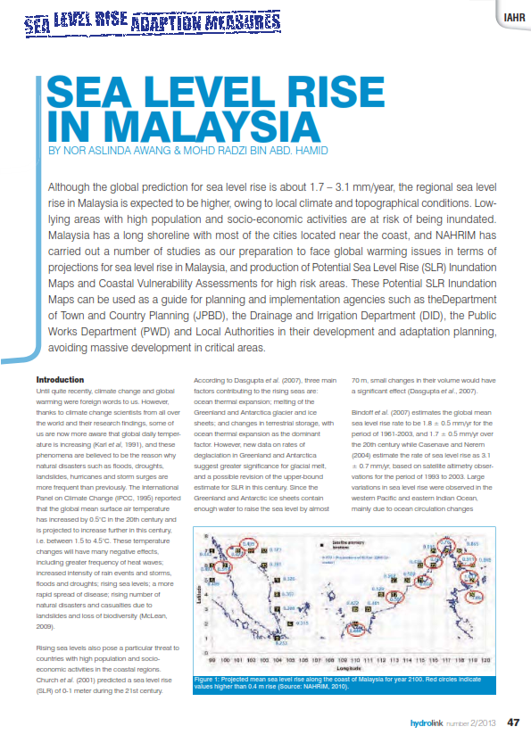
Although the global prediction for sea level rise is about 1.7 – 3.1 mm/year, the regional sea level rise is expected to be higher, depending on the local climate and topographical condition. Therefore, the low-lying areas with high population and socio-economic activities are at risk of being inundated. As Malaysia has a long shoreline with most of the cities are located near the coast, NAHRIM had carried out a number of studies as our preparation to face the global warming issues, namely, projections for sea level rise in Malaysia, produce some Potential Sea Level Rise (SLR) Inundation Maps and Coastal Vulnerability Assessments for high-risk areas. These Potential SLR Inundation Maps can be used by as a guide for planning and implementation agencies such as Department of Town and Country Planning (JPBD), Drainage and Irrigation Department (DID), Public Works Department (PWD) and Local Authorities in their development and adaptation planning, avoiding massive development in critical area.
Authors
Abstract
Although the global prediction for sea level rise is about 1.7 – 3.1 mm/year, the regional sea level rise is expected to be higher, depending on the local climate and topographical condition. Therefore, the low-lying areas with high population and socio-economic activities are at risk of being inundated. As Malaysia has a long shoreline with most of the cities are located near the coast, NAHRIM had carried out a number of studies as our preparation to face the global warming issues, namely, projections for sea level rise in Malaysia, produce some Potential Sea Level Rise (SLR) Inundation Maps and Coastal Vulnerability Assessments for high-risk areas. These Potential SLR Inundation Maps can be used by as a guide for planning and implementation agencies such as Department of Town and Country Planning (JPBD), Drainage and Irrigation Department (DID), Public Works Department (PWD) and Local Authorities in their development and adaptation planning, avoiding massive development in critical area.
Citation
Nor Aslinda Awang, Mohd Radzi Abd Haid. 2013. Sea Level Rise in Malaysia. Digital NAHRIM Publication Repository.