
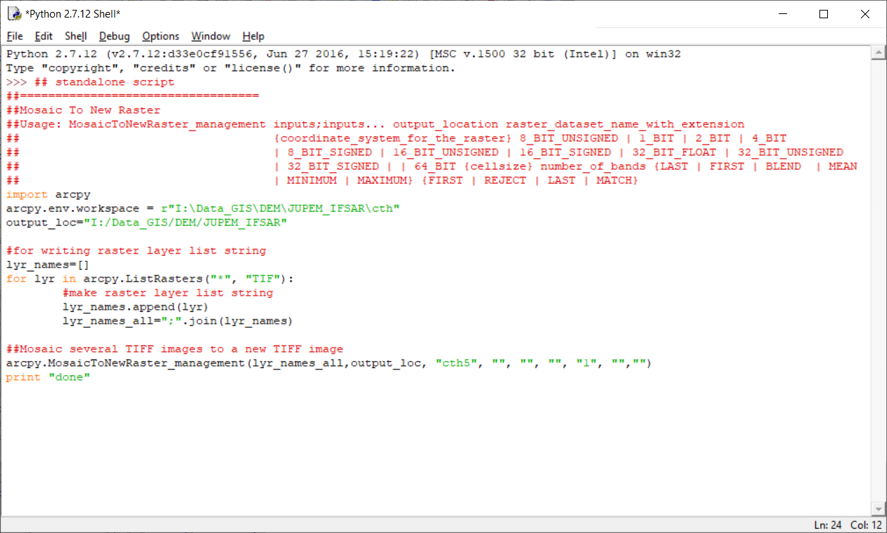
ArcGIS Python script for automated raster mosaic (DEM)
ArcGIS Python script for automated raster processing - mosaic raster tiles, specifically for Digital Elevation Model (DEM) using Mosaic To New Raster function in ArcGIS. For both ArcMap and standalone Python environment.
Language: English
Document code: 8705d0c8-709d-11ed-a315-fa163eda1aa9
Research Area: Information Technology / Computer Science
Published Year: 2017
DOI: —
ISBN / ISSN: —
Authors
Abstract
ArcGIS Python script for automated raster processing - mosaic raster tiles, specifically for Digital Elevation Model (DEM) using Mosaic To New Raster function in ArcGIS. For both ArcMap and standalone Python environment.
Citation
GOH YEE CAI. 2017. ArcGIS Python script for automated raster mosaic (DEM). Digital NAHRIM Publication Repository.